Home
Map
Waterfalls
Download
Articles
Contact
About
About
History
View the team
EN
BG
×
Waterfall Details
Loading...
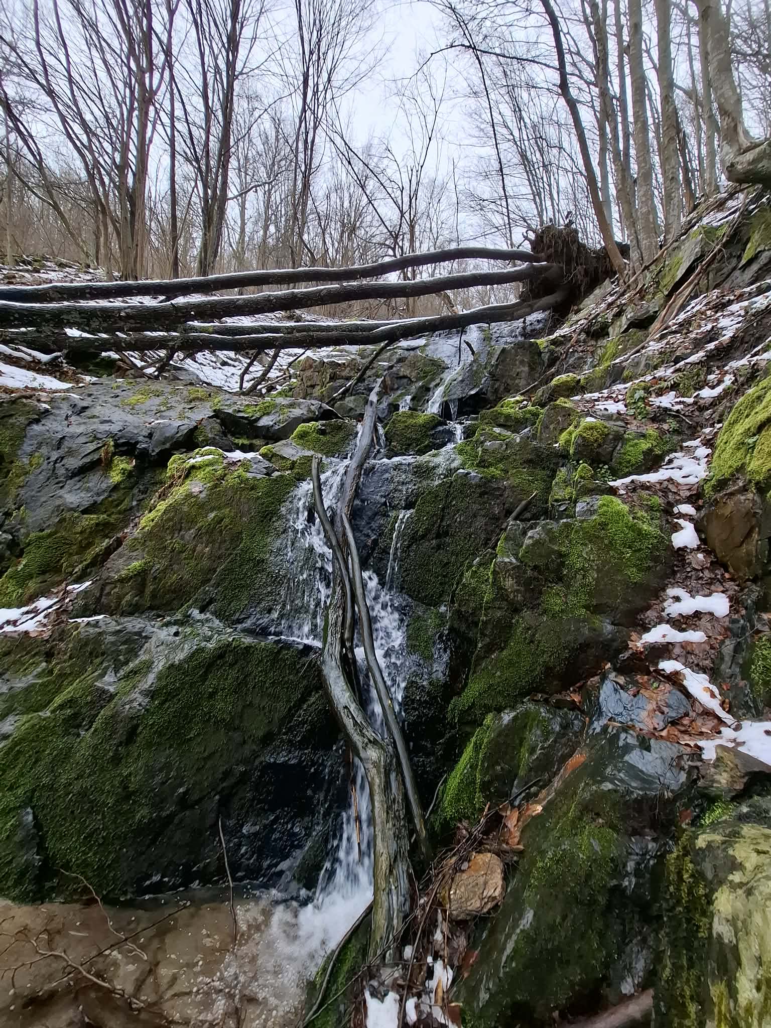
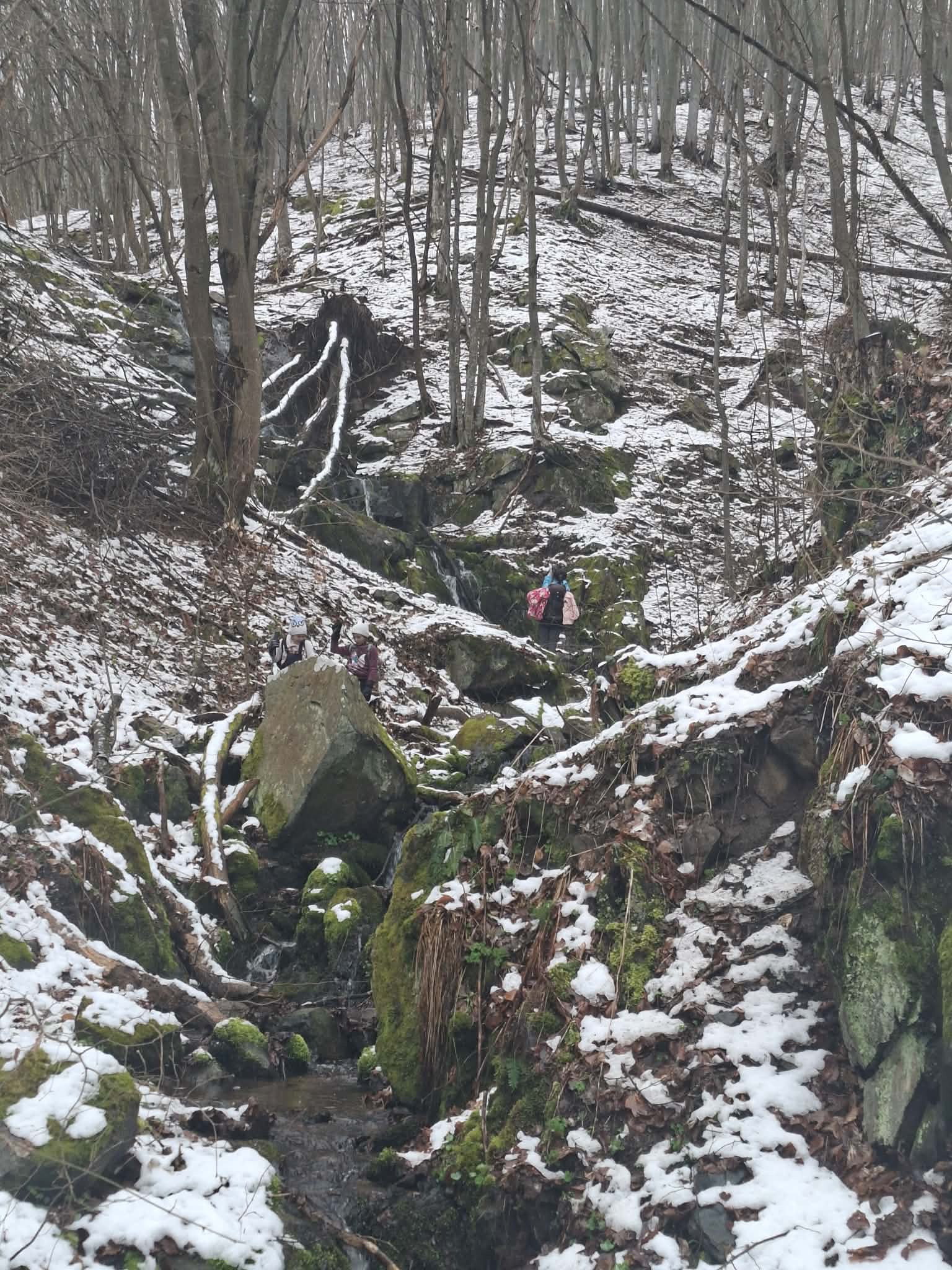
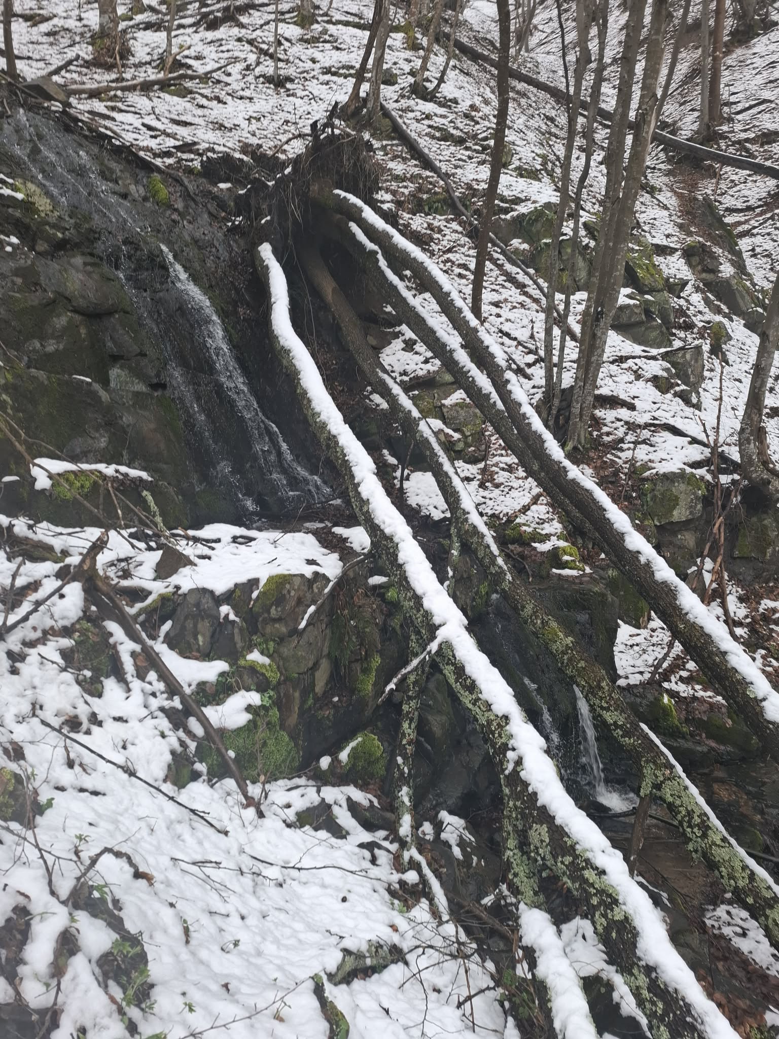
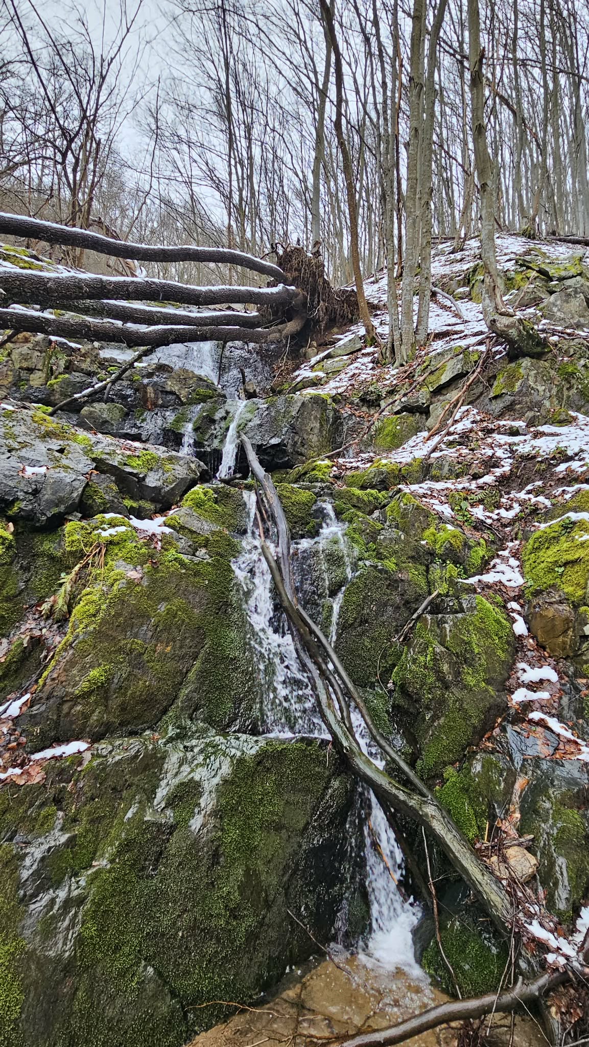
Dabov Chukar Waterfall
Sredna Gora and Kraishte
Verified
Last updated: 15.06.2026
Previous
Next
Share
Google Maps
Directions
Report
To Map
Details
River basin
Danube - Iskar
Flow
Seasonal
Access
Difficult
Mountain
Plana Mountain
Region
Sofia-grad
Flow Rate
Low flow
Shape
Tiered
Coordinates
42.5422860, 23.4002950
Description
Height 10-12 m.
Photos by Anna Karkovska and Daniela Pomakova
Rating
0.0
(
0
ratings)
Your rating:
Map
Weather
Monday
26°
/ 14°
Few clouds
Tuesday
23°
/ 10°
Light rain
Wednesday
21°
/ 10°
Overcast clouds
Thursday
20°
/ 11°
Scattered clouds
Nearby waterfalls
Name
Distance
Actions
Водопад Голяма Поркалица
5.4 km
View
Водопад Самоковището
6.7 km
View
Сакошки водопад 5
8.5 km
View
Сакошки водопад 4
8.5 km
View
Сакошки водопади 1
8.7 km
View
Сакошки водопади 2
8.7 km
View
Сакошки водопад 2
9.0 km
View
Сакошки водопад 1
9.1 km
View
Share
Open in Google Maps
Get Directions
Report an Issue
Back to Map
Details
River basin
Danube - Iskar
Flow
Seasonal
Access
Difficult
Mountain
Plana Mountain
Region
Sofia-grad
Flow Rate
Low flow
Shape
Tiered
Coordinates
42.5422860, 23.4002950
Report an Issue
Issue Type
Select...
Wrong Category
Wrong River
Wrong Status
Wrong Access Type
Wrong Name
Wrong Location
Wrong Description
Wrong/Missing Images
Other Issue
Description
Attach Images (optional)
Max: 5MB per image
Your Name
Your Email