Home
Map
Waterfalls
Download
Articles
Contact
About
About
History
View the team
EN
BG
×
Waterfall Details
Loading...
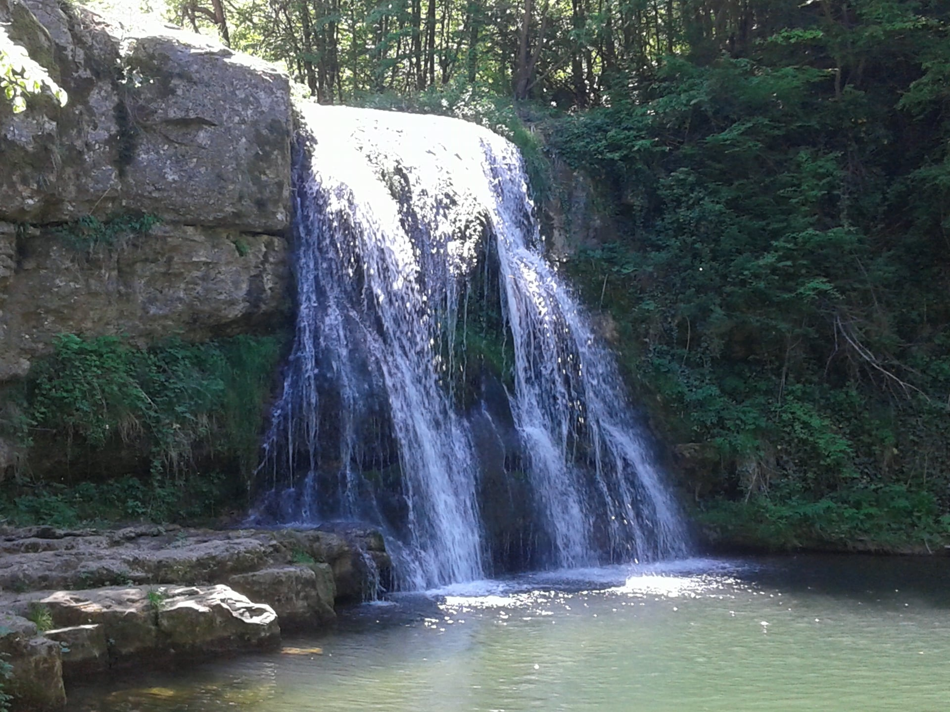
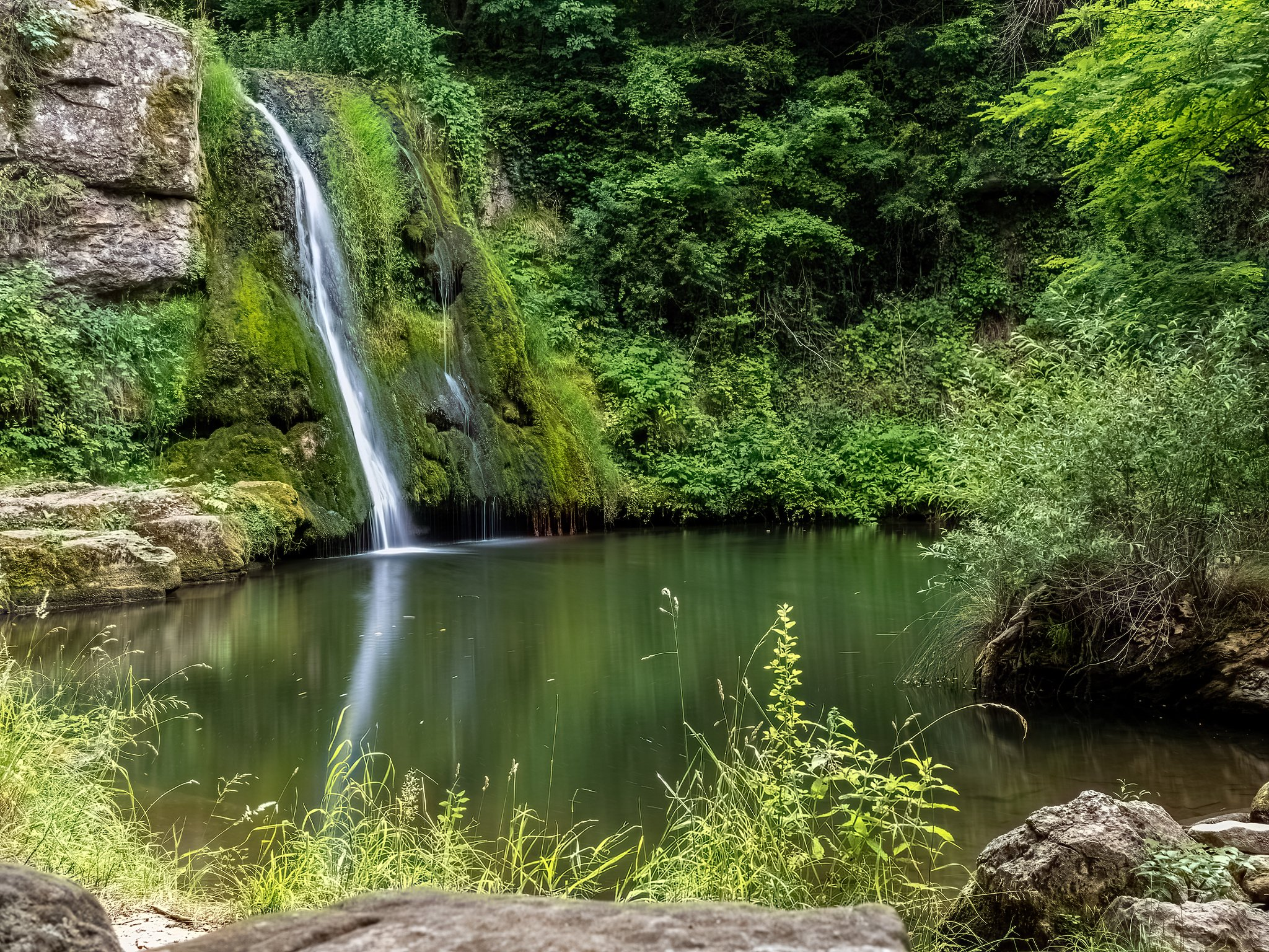
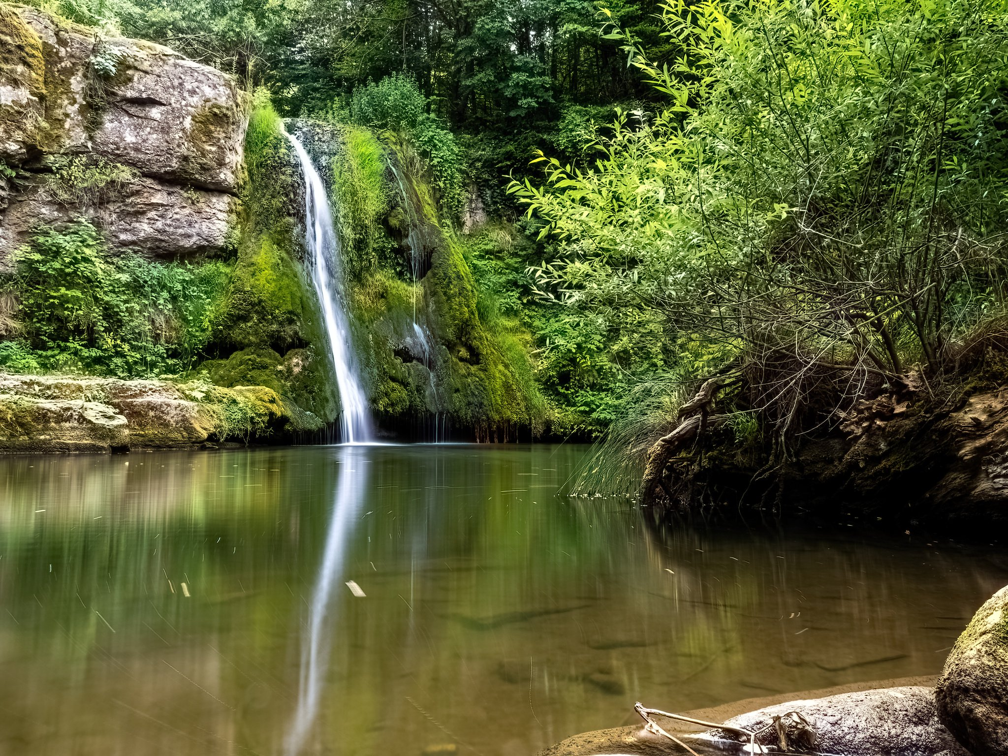
Ivanilovski Waterfall
Forebalkan and Danubian plain
Verified
Last updated: 14.06.2026
Previous
Next
Share
Google Maps
Directions
Report
To Map
Details
River basin
Danube - Yantra
Flow
Seasonal
Access
Moderate
Mountain
Forebalkan
Region
Gabrovo
Flow Rate
Low flow
Shape
Segmented
Coordinates
42.9507919, 25.3159174
Description
Height 7-8 m.
Photos by Georgi Georgiev and Slavi Kotarov
Rating
0.0
(
0
ratings)
Your rating:
Map
Weather
Monday
22°
/ 14°
Moderate rain
Tuesday
23°
/ 13°
Light rain
Wednesday
25°
/ 13°
Scattered clouds
Thursday
21°
/ 14°
Scattered clouds
Nearby waterfalls
Name
Distance
Actions
Горен Иваниловски водопад
0.9 km
View
Водопад Кози рог
2.3 km
View
Горен Сарайски водопад
4.8 km
View
Долен Сарайски водопад
4.9 km
View
Праг Златевци
6.1 km
View
Водопад Скокa (Армените)
6.8 km
View
Горен водопад Андъка
9.2 km
View
Водопад Андъка
9.3 km
View
Share
Open in Google Maps
Get Directions
Report an Issue
Back to Map
Details
River basin
Danube - Yantra
Flow
Seasonal
Access
Moderate
Mountain
Forebalkan
Region
Gabrovo
Flow Rate
Low flow
Shape
Segmented
Coordinates
42.9507919, 25.3159174
Report an Issue
Issue Type
Select...
Wrong Category
Wrong River
Wrong Status
Wrong Access Type
Wrong Name
Wrong Location
Wrong Description
Wrong/Missing Images
Other Issue
Description
Attach Images (optional)
Max: 5MB per image
Your Name
Your Email