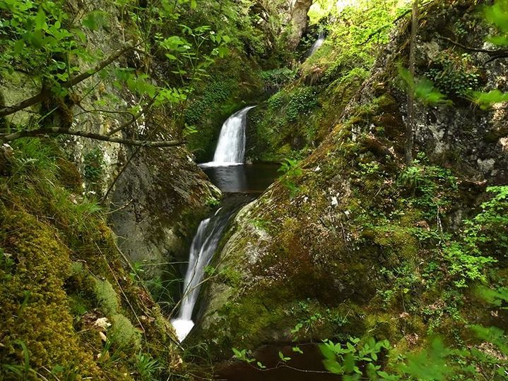
Home
Map
Waterfalls
Download
Articles
About
EN
BG
×
Waterfall Details
Loading...
Kazanite(Chavdar) Waterfalls
Sredna Gora and Kraishte
Verified
Last updated: 20.04.2026
Share
Google Maps
Directions
Report
To Map
Details
River basin
Maritsa - Topolnitsa
Flow
Perennial
Access
Difficult
Mountain
Sredna Gora
Region
Sofijska
Flow Rate
Low flow
Shape
Tiered
Coordinates
42.6122132, 24.0629071
Description
Height 2-4 m.
Photo by Dimitar Rashev
Rating
5.0
(
1
ratings)
Your rating:
Map
Weather
Monday
18°
/ 7°
Overcast clouds
Tuesday
13°
/ 6°
Broken clouds
Wednesday
9°
/ 5°
Light rain
Thursday
11°
/ 4°
Overcast clouds
Nearby waterfalls
Name
Distance
Actions
Долен водопад Бобовица
13.1 km
View
Водопад Бобовица 2
13.1 km
View
Водопад Бобовица
13.3 km
View
Водопад Бобовица 4
13.3 km
View
Водопад Бобовица 6
13.3 km
View
Горен водопад Бобовица
13.3 km
View
Златишки водопад
14.5 km
View
Сенокоски водопад
14.6 km
View
Share
Open in Google Maps
Get Directions
Report an Issue
Back to Map
Details
River basin
Maritsa - Topolnitsa
Flow
Perennial
Access
Difficult
Mountain
Sredna Gora
Region
Sofijska
Flow Rate
Low flow
Shape
Tiered
Coordinates
42.6122132, 24.0629071
adresi.bg
Всичко за Акт 16
Кодове авто боя
Български железници
Проверка ЕГН
Проверка ЕИК
Учи HTML
Избери хостинг
Всичко за отпуск
Нова идентичност
RAL каталог
Преброяванеg
Скъси линк
Безплатен хостинг
SEO линкове
Всичко за трафика
Водопади в България
Report an Issue
Issue Type
Select...
Wrong Category
Wrong River
Wrong Status
Wrong Access Type
Wrong Name
Wrong Location
Wrong Description
Wrong/Missing Images
Other Issue
Description
Attach Images (optional)
Max: 5MB per image
Your Name (optional)
Your Email (optional)