Home
Map
Waterfalls
Download
Articles
Contact
About
About
History
View the team
EN
BG
×
Waterfall Details
Loading...
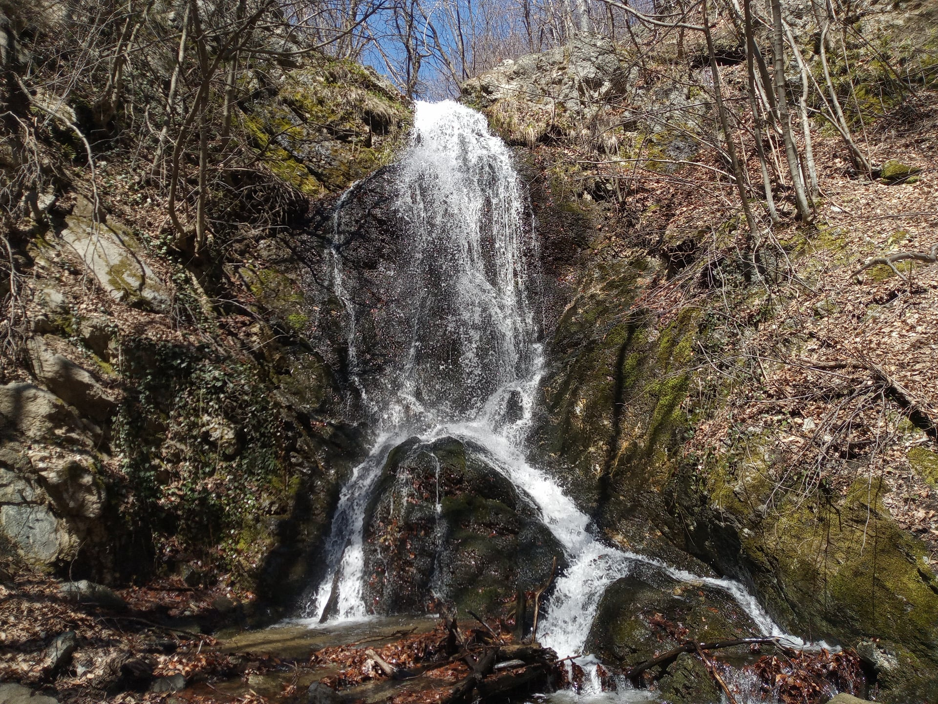
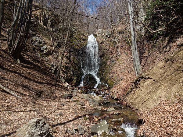
Strenski Dol Waterfall
Sredna Gora and Kraishte
Verified
Last updated: 14.06.2026
Previous
Next
Share
Google Maps
Directions
Report
To Map
Details
River basin
Maritsa - Topolnitsa
Flow
Perennial
Access
Moderate
Mountain
Sredna Gora
Region
Sofijska
Flow Rate
Low flow
Shape
Ribbon
Coordinates
42.3487184, 23.9356712
Description
Height 10-12 m.
Photo by Borislav Borislavov
Rating
0.0
(
0
ratings)
Your rating:
Map
Weather
Monday
22°
/ 14°
Broken clouds
Tuesday
23°
/ 11°
Light rain
Wednesday
21°
/ 11°
Overcast clouds
Thursday
21°
/ 11°
Scattered clouds
Nearby waterfalls
Name
Distance
Actions
Водопад Яворица
5.1 km
View
Височки водопад
13.8 km
View
Долен водопад Габровщица
14.3 km
View
Водопад Ошляк 1
14.5 km
View
Водопад Ошляк 2
14.6 km
View
Водопад Ошляк 16
14.6 km
View
Водопад Ошляк 3
14.6 km
View
Водопад Ошляк 17
14.7 km
View
Share
Open in Google Maps
Get Directions
Report an Issue
Back to Map
Details
River basin
Maritsa - Topolnitsa
Flow
Perennial
Access
Moderate
Mountain
Sredna Gora
Region
Sofijska
Flow Rate
Low flow
Shape
Ribbon
Coordinates
42.3487184, 23.9356712
Report an Issue
Issue Type
Select...
Wrong Category
Wrong River
Wrong Status
Wrong Access Type
Wrong Name
Wrong Location
Wrong Description
Wrong/Missing Images
Other Issue
Description
Attach Images (optional)
Max: 5MB per image
Your Name
Your Email