Home
Map
Waterfalls
Download
Articles
About
EN
BG
×
Waterfall Details
Loading...
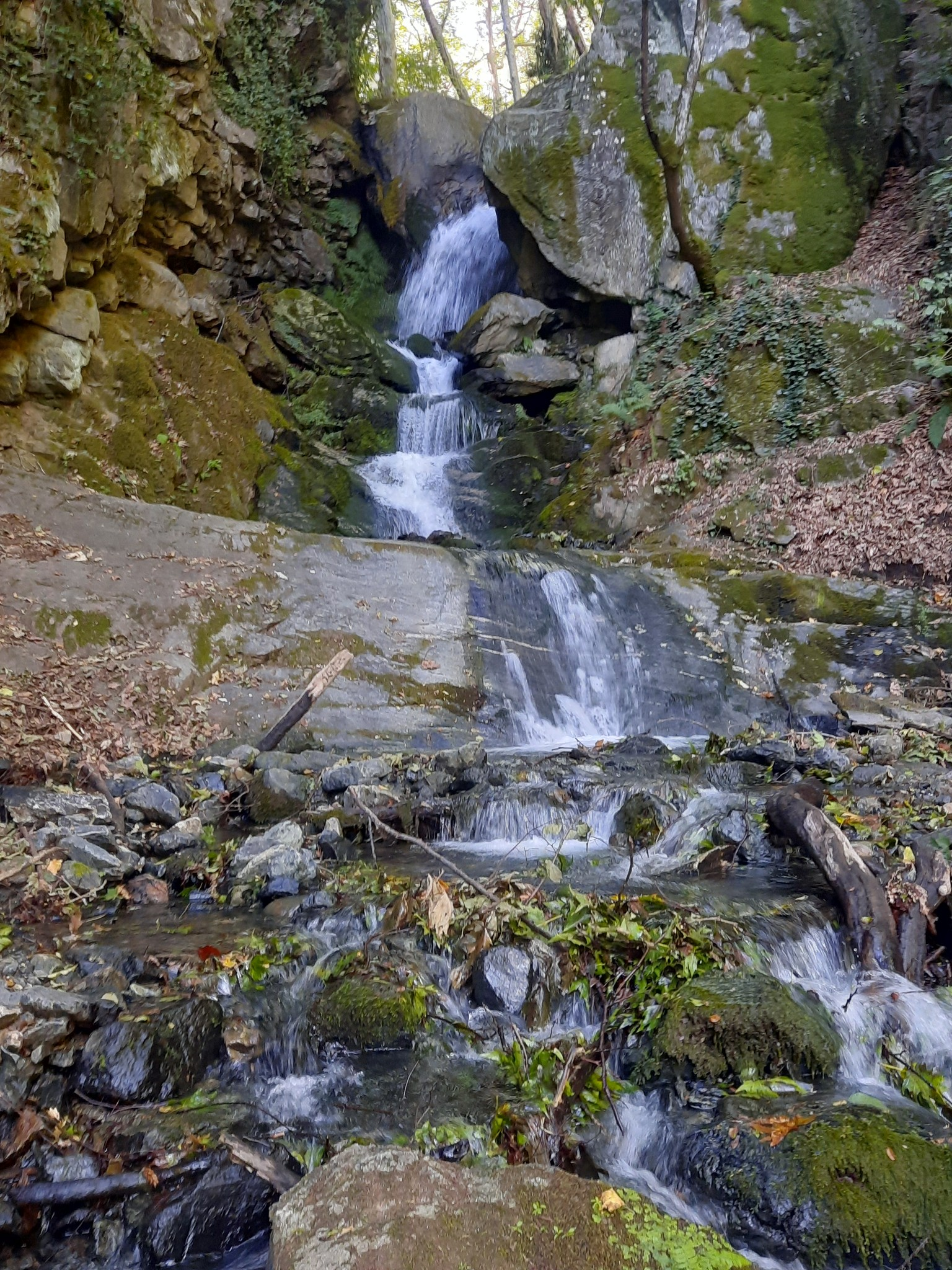
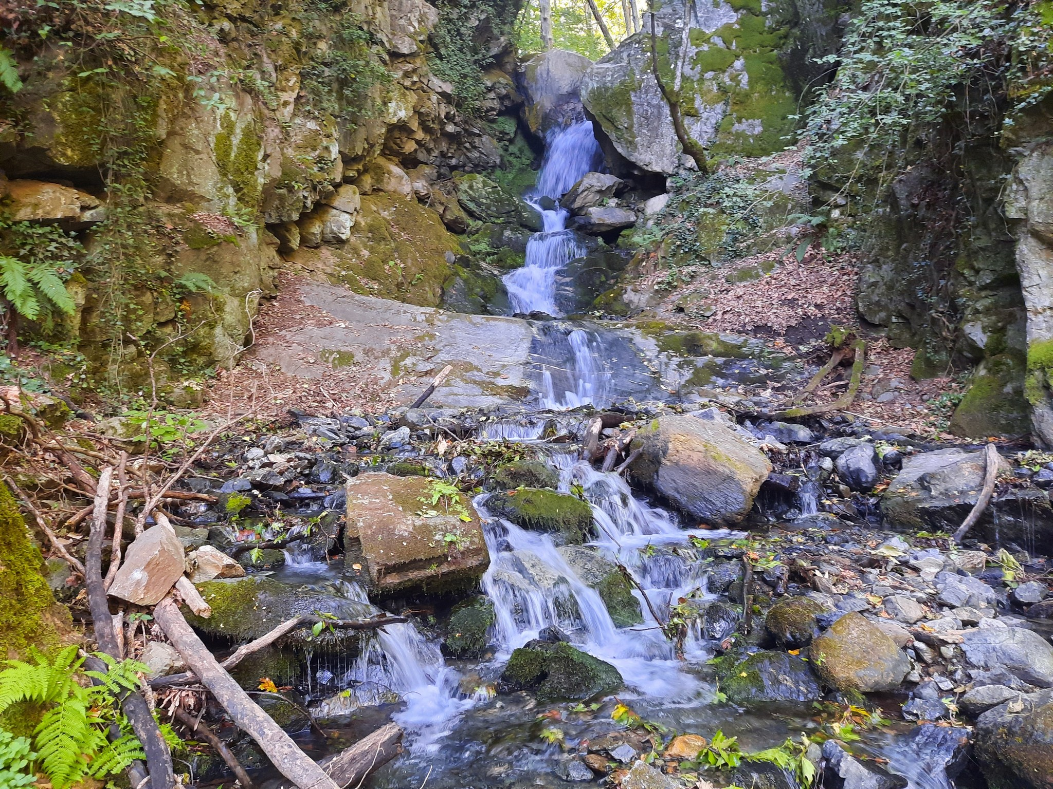
Yavornishki Waterfall
Osogovo and Belasitsa group
Verified
Last updated: 21.05.2026
Previous
Next
Share
Google Maps
Directions
Report
To Map
Details
River basin
Struma - Strumeshnitsa
Flow
Perennial
Access
Moderate
Mountain
Belasitsa
Region
Blagoevgrad
Flow Rate
Low flow
Shape
Cascade
Coordinates
41.3531936, 23.0489892
Description
Total height 6-8 m. and constant flow.
Photos Ivaylo Mitev
Rating
0.0
(
0
ratings)
Your rating:
Map
Weather
Thursday
20°
/ 19°
Overcast clouds
Friday
21°
/ 13°
Overcast clouds
Saturday
23°
/ 13°
Broken clouds
Sunday
24°
/ 13°
Light rain
Nearby waterfalls
Name
Distance
Actions
Камешнишки водопад 1
2.1 km
View
Камешнишки (Срамежливеца) водопад
2.1 km
View
Камешнишки водопад 3
2.1 km
View
Водопад Чатала(Камена)
2.3 km
View
Водопад Чергата
2.6 km
View
Водопад Метлата (Ключ)
2.6 km
View
Водопад Реснача
2.6 km
View
Водопад Вретеното
2.6 km
View
Share
Open in Google Maps
Get Directions
Report an Issue
Back to Map
Details
River basin
Struma - Strumeshnitsa
Flow
Perennial
Access
Moderate
Mountain
Belasitsa
Region
Blagoevgrad
Flow Rate
Low flow
Shape
Cascade
Coordinates
41.3531936, 23.0489892
adresi.bg
Всичко за Акт 16
Кодове авто боя
Български железници
Проверка ЕГН
Проверка ЕИК
Учи HTML
Ахелой
Избери хостинг
Всичко за отпуск
RAL каталог
Преброяванеg
Скъси линк
Безплатен хостинг
SEO линкове
Всичко за трафика
Водопади в България
Report an Issue
Issue Type
Select...
Wrong Category
Wrong River
Wrong Status
Wrong Access Type
Wrong Name
Wrong Location
Wrong Description
Wrong/Missing Images
Other Issue
Description
Attach Images (optional)
Max: 5MB per image
Your Name
Your Email